

Inside Emesent: The Australian Startup Making Autonomous Mapping Possible Without GPS
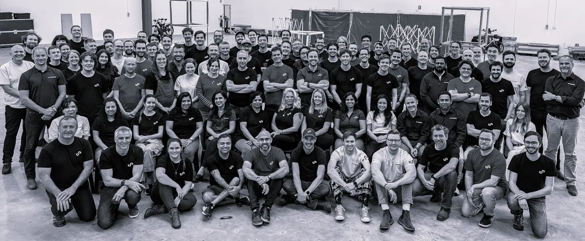
From CSIRO Spinout to Global Robotics Innovator
Many of the world’s most critical industrial environments exist beyond the reach of GPS. Underground mines, tunnels, dense industrial facilities, disaster zones, and complex infrastructure often require accurate mapping under conditions where traditional navigation systems fail. These environments are also among the most hazardous for human operators, making autonomous robotics increasingly valuable. Australian startup Emesent was founded in 2018 as a spinout from Australia’s national science agency, CSIRO, to solve exactly this challenge.
Drawing upon years of robotics research, the company has developed autonomous mapping technologies that allow machines to understand and navigate complex environments without external positioning systems. Today, Emesent supports customers in more than 40 countries and has become one of Australia’s leading Physical AI companies, demonstrating how artificial intelligence, robotics, and spatial computing can work together to automate real-world operations.
Emesent’s Product Portfolio: Autonomous LiDAR Mapping Hardware and Software
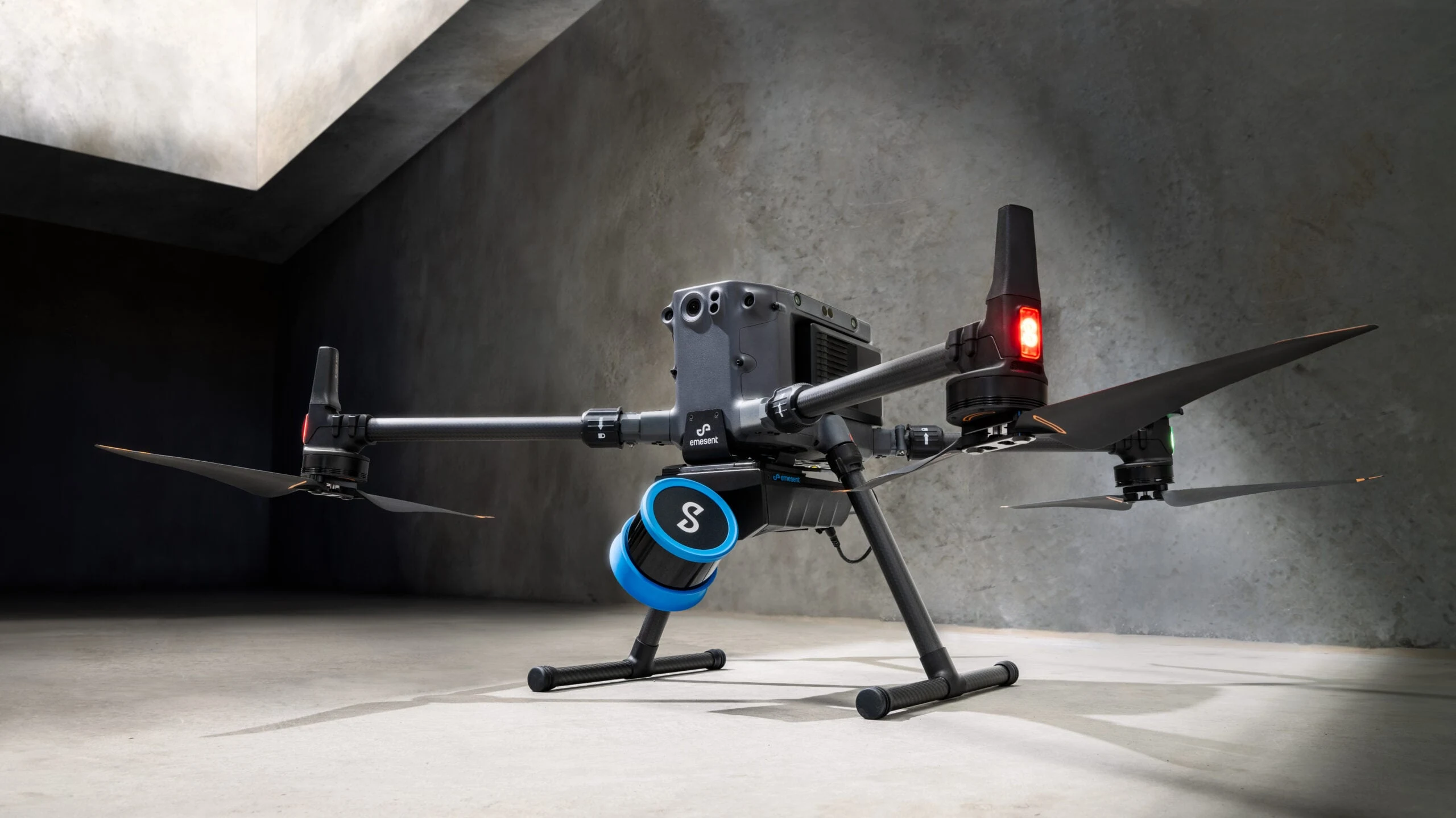
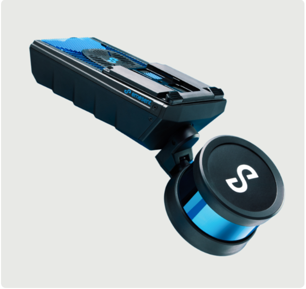
At the center of Emesent’s platform is Hovermap, a mobile LiDAR mapping system that combines autonomous navigation, obstacle avoidance, and three-dimensional scanning into a single solution. Rather than functioning as a standalone drone, Hovermap is designed as a versatile sensing platform that can be mounted on drones, quadruped robots, vehicles, backpacks, and other mobile systems depending on operational requirements.
The broader product ecosystem extends well beyond mapping hardware. Emesent also offers software platforms such as Commander, Cortex, and Aura, alongside a growing portfolio of accessories and deployment systems that support different industrial workflows. Together, these technologies enable autonomous data collection, high-resolution three-dimensional mapping, and advanced spatial analysis across environments where manual surveying would be difficult, dangerous, or prohibitively expensive. By integrating hardware, autonomy software, and AI-driven data processing into a unified platform, Emesent is building an end-to-end solution for autonomous spatial intelligence.
How Emesent’s Solutions Are Transforming Mining, Construction, and Infrastructure
Emesent’s technology has found applications across industries where accurate spatial data directly influences operational safety and productivity. Mining remains one of its strongest markets, with autonomous mapping supporting underground production, stope reconciliation, open-pit surveys, cavity monitoring, stockpile measurement, and change detection. These capabilities allow mining companies to collect detailed geological and operational data while reducing worker exposure to hazardous environments.
Beyond mining, the company’s autonomous mapping solutions are increasingly used across construction, civil engineering, and infrastructure management. Applications include bridge inspections, topographic surveys, scan-to-BIM workflows, infrastructure documentation, and as-built verification. Because Hovermap can operate in confined, hazardous, and GPS-denied locations, organizations gain access to accurate spatial information without interrupting ongoing operations. This combination of safety, efficiency, and repeatability has positioned autonomous LiDAR mapping as an increasingly valuable tool for infrastructure owners and industrial operators worldwide.
Emesent Secures $25 Million to Expand into Defence and Autonomous Robotics
Emesent recently secured $25 million in new funding from investors including NGS Super, Hostplus, Main Sequence, and the National Reconstruction Fund (NRF). The investment will support continued product development, international expansion, and deeper penetration into defense and autonomous robotics markets.
The funding reflects growing recognition that technologies originally developed for industrial mapping have significant applications within national security. Autonomous systems capable of navigating GPS-denied environments, building real-time three-dimensional maps, and operating with minimal human intervention are becoming increasingly relevant for military reconnaissance, infrastructure protection, search-and-rescue operations, and disaster response. As governments worldwide accelerate investment in autonomous technologies, companies with proven real-world deployment experience are attracting increasing strategic interest.

Can Emesent Help Shape the Future of Physical AI?
Artificial intelligence has traditionally focused on digital environments, processing documents, generating text, or analyzing images. Physical AI extends those capabilities into the real world by enabling machines to perceive, understand, and interact with physical environments autonomously. This shift requires the integration of robotics, sensors, spatial computing, machine learning, and autonomous navigation.
Emesent sits at the intersection of these technologies. Rather than building AI systems that operate exclusively on screens, the company enables autonomous machines to navigate mines, tunnels, industrial facilities, and critical infrastructure while continuously generating high-resolution spatial intelligence. This capability has implications far beyond mapping itself. As autonomous robots become increasingly common across logistics, construction, defense, manufacturing, and energy, accurate real-time understanding of physical environments will become foundational infrastructure for machine autonomy.
Whether deployed underground, above ground, indoors, or outdoors, platforms like Emesent’s demonstrate that the next evolution of artificial intelligence will not simply interpret digital information. It will increasingly understand, navigate, and operate within the physical world itself.
Emesent illustrates how Physical AI is moving beyond laboratory research into large-scale industrial deployment. By combining autonomous navigation, LiDAR, and spatial intelligence, the company is solving problems that conventional AI cannot address. As autonomous machines become more capable, technologies that allow them to perceive and navigate complex physical environments may become just as important as the AI models that power their decision-making.